


Your account
Sign in or create one
ifalls.news is free to read. An account keeps your saved items and settings.


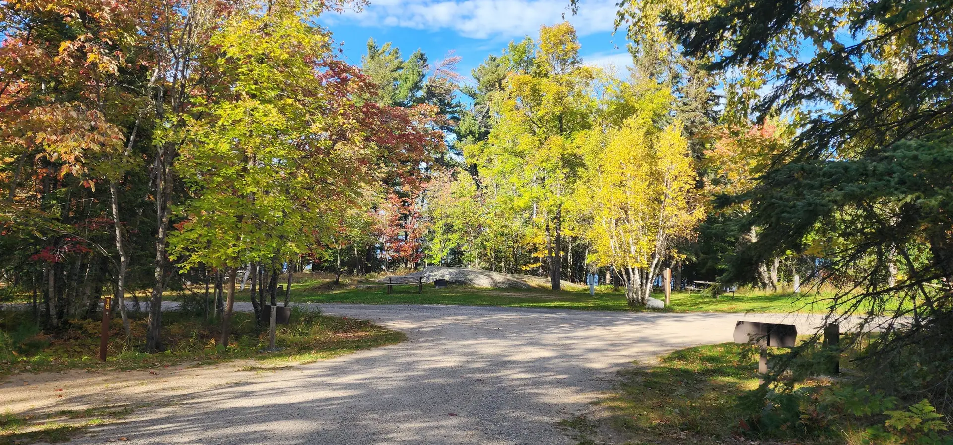
A free Chippewa National Forest campground two miles northwest of Wirt, with drive-in sites among birch and white pine and carry-in access to Noma Lake.
Noma Lake Campground is a Chippewa National Forest campground two miles northwest of Wirt on County Road 31, south of the Koochiching County line in Itasca County and an easy drive from International Falls. The sites are drive-in, on short gravel spurs a few steps off the road. The Forest Service now lists it as a backcountry site, which here means no fee, no reservations and no services rather than a hike in; there is a vault toilet.
The sites sit in a stand of paper birch and white pine, each with a picnic table and a steel fire ring... Read more


The Rat Root Picnic Site is a Koochiching County water-access picnic and camping site on the lower Rat Root River, with a canoe landing and a bench above a riprap point.
The Rat Root Picnic Site is a public water-access picnic and camping site on the lower Rat Root River, on Koochiching County land managed by the county’s Land & Forestry Department. It sits near the north end of Rat Root Lake, one of three county water-access sites along this stretch of river — between the Cormorant Campsite and the Fish Camp Campsite. A rock-riprap point with steps down to the water gives canoes and small boats a place to land, and a mowed clearing above the shore holds a bench for a rest or a shore lunch.
The county’s Land... Read more

The Fish Camp Campsite (#2693) is a Koochiching County public water-access campsite on the lower Rat Root River, with a picnic table, fire area, and canoe landing.
The Fish Camp Campsite is a public water-access campsite on the lower Rat Root River, on Koochiching County land managed by the county’s Land & Forestry Department. Its sign reads ‘Fish Camp Campsite — Koochiching County Land and Forestry,’ and a blue marker post at the water designates it as site number 2693. The site sits in a mowed clearing under red and white pines, where the river runs the last stretch toward Black Bay of Rainy Lake.
A picnic table, a bench, a bear-proof storage box, and a fire area sit above a riprap shoreline, with stone steps down... Read more

Bass Lake County Park and Campground is a 663-acre Itasca County park with 43 campsites, four lakes, a swimming beach, and miles of multi-use trails between Effie and Togo.
Bass Lake County Park and Campground encompasses 663 acres of red and white pine, spruce, aspen, and cedar off State Aid Highway 1, eleven miles east of Effie and eleven miles west of Togo. Managed by the Itasca County Land Department, the park was purchased by the county in 1984 from the Boise Cascade Corporation with the help of a federal Land and Water Conservation Fund grant. Four lakes lie within its borders: Bass and Duck each have a county boat ramp, Erskine is a carry-in trout lake stocked with rainbow trout and splake, and Sucker rounds out the set.... Read more


Togo Horse Camp is a DNR equestrian campground in George Washington State Forest with 12 pull-through campsites, picket lines, and 19 miles of signed trails.
Togo Horse Camp is one of two horse campgrounds in George Washington State Forest, tucked into the red pines off County Road 551 near Togo. The camp offers 12 primitive equestrian campsites — a cleared area, fire ring, and picnic table at each — with pull-through parking, picket lines at every site, manure bunkers, and an accessible horse loading ramp. Portable corrals and electric fences are welcome, as long as they don’t encircle trees.
Two accessible vault toilets, garbage dumpsters, and drinking water serve the camp, and the well can be pumped by hand or by hooking up your own... Read more


Thistledew Lake Campground is a DNR state-forest campground with 21 drive-in campsites, a swimming beach, and first-rate walleye fishing on a clear 326-acre lake near Togo.
Thistledew Lake Campground sits on the shore of its namesake lake in George Washington State Forest, about five miles southwest of Togo off County Road 551. The forest — created by the Minnesota Legislature in 1931 to mark the 200th anniversary of George Washington’s birth — spreads across 320,534 acres of northeastern Itasca County, and Thistledew is one of its eight campgrounds and one of just three with a swimming beach and picnic day-use area (Owen Lake and Bear Lake are the others).
The campground offers 21 drive-in campsites, two of them accessible, in the classic primitive state-forest style:... Read more


Municipal campground on the Big Fork River in Big Falls, Minnesota. Home to Grand Falls, a set of powerful rapids viewable from the campground grounds.
Big Falls Municipal Campground sits on the Big Fork River in the town of Big Falls, about 39 miles south of International Falls on Highway 71. The campground is home to Grand Falls, a set of powerful rapids on the Big Fork River.
The rapids are viewable directly from the campground grounds. A wide, flat rock shelf above the water provides easy access to the viewing area without a hike. Parking is ample. The rapids are especially impressive in spring when water levels are high from snowmelt and rain.


Pine Aire Resort offers a delightful escape for families of nature lovers!
Pine Aire Resort sits on the south shore of Lake Kabetogama, about 3 miles off Highway 53. It’s been a family-run spot for years, and the current owners, Denise and Niles, are the kind of people who’ll help you back your trailer in, point you toward where the walleye have been hitting, and still have the coffee going when you drag yourself back to the dock at dark.
They’ve got 15 comfortable cabins where you can relax after a day on the water. All clean, all with WiFi (yes, even out there), charcoal... Read more
Dispersed camping is a way to camp for FREE in Minnesota!
Dispersed camping is a way to camp for free in Minnesota. It is a type of camping that takes place out of a designated campground and is a true outdoor experience. When dispersed camping you are far from other people and amenities.
When disperse camping you may camp in a clearing in the woods or a preexisting site. You cannot cut any trees or vegetation to make new campsites. Some great places to look are clearings, meadows, or timber clearings. You must be at... Read more


Loman Park offers a campground and boat landing!
Loman Park offers a campground and public access to Black River!


Lofgren Park offers public water access, a campground, disc golf, and more!
Lofgren Park offers public water access, a campground, disc golf, and more!


Woodenfrog Campground offers primitive campsites, public water access, public beach and hiking trails!
Woodenfrog State Forest Campground offers 61 primitive Campsites. Each site has a fire ring, picnic table, toilet access, and seasonal drinking water. Sites are first come, first served!
Campsites can be booked using the Yodel portal.
Rules for this place
State forest camping runs on the DNR’s state forest rules, which set how long a stay may run in a developed campground. Camping away from a developed campground in a state forest is allowed under the DNR’s dispersed camping rules, which set how far from water, from... Read more




Lofgren Park Landing offers a campground, disk golf and public water access.
Rules for this place
The border waters section of the Minnesota fishing regulations covers only the lower reach of the Little Fork River, and the water above that point is not in it. Minnesota’s invasive species law rides home with the trailer: pull the drain plug, drain the water, and leave plants and prohibited species at the access. Part of the Little Fork River is on the DNR’s infested waters list for... Read more


Franz Jevne State Park is a quaint, beautiful place to surround yourself with nature!
Franz Jevne State Park, located in northern Minnesota along the Rainy River, is the state’s smallest park, encompassing about 120 acres. Despite its size, this secluded park offers a peaceful retreat with scenic views of Ontario across the river and a range of activities for nature enthusiasts.
The park’s landscape includes a mix of hardwood forests, rocky outcrops, and lush floodplains, providing habitat for a variety of wildlife. Visitors might encounter animals such as black bears, moose, and bald eagles, making it a popular spot... Read more


Rainy Lake RV is a charming campground located on the picturesque shores of Rainy Lake in International Falls, Minnesota!
Rainy Lake RV is a charming campground located on the picturesque shores of Rainy Lake in International Falls. Established in 2019, this 32-acre private campground has quickly become a favorite for RV enthusiasts looking to park in a scenic setting. It offers 40’ x 50’ full hookup sites which include sewer, 20/30/50 amp electric, water, and a dock slip with electricity in a protected harbor, perfect for those who wish to fish or boat in both the US and Canada.
The campground is equipped with amenities like fire rings, picnic tables, and a fish cleaning facility, ensuring a comfortable stay.... Read more

Ash River Campground offers campsites, river access, and more!
At Ash River Campground each site has a picnic table, fire ring, toilet access, and seasonal drinking water. First come, first served!


International Falls City Beach has campsites, a large picnic pavilion, a beach volleyball court, and more!
Beach/campground rules/regulations:


The Vermilion River stretches 42 miles northward from Lake Vermilion to Crane Lake, meandering through the Kabetogama State Forest!
Stretching approximately 40 miles from Lake Vermilion to Crane Lake, the Vermilion River flows generally northward through the Kabetogama State Forest. Along this path, paddlers are surrounded by forests of pine, spruce, fir, aspen, and birch, with scenic stretches of exposed bedrock and bluffs. The most developed areas along the river are near Vermilion and Crane Lakes and the town of Buyck.
With limited access points and a variety of rapids, the Vermilion River is best suited to experienced paddlers. Gradual water level changes... Read more
Big Fork River flows north through a landscape of pine, spruce, fir, cedar, aspen, and birch forests to Rainy River!
The Big Fork River winds north through a rich landscape of pine, spruce, fir, cedar, aspen, and birch forests until it joins the Rainy River. Along its path, the towns of Bigfork and Big Falls serve as the main developed areas, offering convenient points for river access.
Anglers will find excellent fishing opportunities along the Big Fork, with species like walleye, northern pike, and smallmouth bass plentiful in its waters. The river is also a haven for birdwatchers, with frequent sightings... Read more


Smokey Bear State Forest is nestled in northern Minnesota’s Koochiching County, covering 12,276 acres. Located near the mouth of the Big Fork River, just south of the Canada border!
This northern forest is named after the iconic figure Smokey Bear, symbolizing wildfire prevention and forest conservation—a fitting namesake for this scenic and ecologically significant area. Smokey Bear State Forest spans across 12,276 acres. This vast, scenic area is known for its natural beauty and is a popular destination for outdoor enthusiasts.
In the warmer months, visitors enjoy hiking, biking, canoeing, and fishing in the forest’s rivers and lakes. During winter, snowmobiling, cross-country skiing, and snowshoeing offer unique ways to experience the snowy landscape.
The forest... Read more


