


Your account
Sign in or create one
ifalls.news is free to read. An account keeps your saved items and settings.


Caldwell Spur is a 0.4-mile minimum-maintenance state forest road off Caldwell Forest Road in Pine Island State Forest.
Caldwell Spur is a 0.4-mile minimum-maintenance state forest road branching off Caldwell Forest Road in Pine Island State Forest. The white sign at the junction reads “Caldwell Spur — Minimum Maintenance — State Forest Road 1641 — Road may be impassable — Travel at your own risk,” and the route leaves the mainline as a grassy two-track disappearing into the brush.
Minimum-maintenance forest roads are the roughest class in the DNR system — graveled or native soil, often a single lane wide, and maintained only enough to stay passable in dry conditions. Like the rest of Pine Island State Forest,... Read more


Caldwell Forest Road runs 10.9 miles between East Gemmell Ridge Forest Road and Highway 6, linking the Pine Island and Koochiching state forests.
Caldwell Forest Road runs 10.9 miles between the south end of East Gemmell Ridge Forest Road and State Highway 6, with routed DNR signs at both ends — the east entrance sits about 59 road miles from International Falls, a mile west of Highway 6. The DNR’s road inventory carries the route as the Caldwell Brook road, and along the way it crosses two named tributaries of the Big Fork River: Caldwell Brook, under a timber-deck bridge, and Plum Creek — streams that join the Big Fork at river miles 83.1 and 85.4 of the state water trail. Midway, a... Read more


Lost River Forest Road runs 3.3 miles north from West Gemmell Ridge Forest Road through the red pine country of southern Pine Island State Forest.
Lost River Forest Road runs 3.3 miles north from its junction with West Gemmell Ridge Forest Road, deep in the red pine country of southern Pine Island State Forest. A fire-number sign and a destination board pointing toward Kelliher and Waskish stand at the junction, and northward the road narrows to a grassy two-track through dense aspen. It shares its name with the Lost River, the only stream of that name in Koochiching County, which rises a few miles south of the road’s course.
Pine Island is Minnesota’s largest state forest at 900,153 acres, a country of pine “islands” amid... Read more


East Gemmell Ridge Forest Road angles 8 miles southeast through southern Pine Island State Forest, crossing Dinner Creek along the way.
East Gemmell Ridge Forest Road angles 8 miles southeast through southern Pine Island State Forest, from its signed junction with West Gemmell Ridge Forest Road to the west end of Caldwell Forest Road. The drive threads young aspen regeneration, shaded canopy tunnels, and stands of mature red and white pine, and midway the road crosses Dinner Creek, a dark little stream meandering through an open sedge meadow beside the roadbed.
Pine Island is Minnesota’s largest state forest — 900,153 acres of pine “islands” amid the peatlands left by glacial Lake Agassiz — and its roads carry the DNR’s “managed” motor-vehicle... Read more


West Gemmell Ridge Forest Road runs 5 miles through southern Pine Island State Forest, meeting Lost River Forest Road in a stand of mature red pine.
West Gemmell Ridge Forest Road runs 5 miles west from its junction with East Gemmell Ridge Forest Road in southern Pine Island State Forest, about 56 road miles from International Falls. A routed DNR sign and the standard state-forest motor-vehicle rules board mark the east entrance; three miles in, the road meets Lost River Forest Road in a stand of mature red pine, where a destination sign points onward toward Kelliher and Waskish. Near the west end, a Grant-in-Aid snowmobile trail — Corridor 84 West — crosses the route, and hay-meadow edges, tamarack snags, and aspen walls fill out the... Read more


Porter Ridge Road is a DNR forest road running 6.2 miles east to west through Pine Island State Forest, about 46 miles south of International Falls.
Porter Ridge Road is a DNR system forest road running 6.2 miles east–west through Pine Island State Forest, about 46 road miles south of International Falls. A routed wooden sign standing in a wildflower meadow and a steel gate mark the west entrance, and from there the dirt lane rolls through tall red pine plantation, grassy two-track stretches, aspen and birch tunnels, and past a marsh-rimmed pond where a transmission line strides across the far shore.
Pine Island is Minnesota’s largest state forest — 900,153 acres of pine “islands” rising out of peatlands, bogs, and shrub swamps left behind by... Read more


Phone Box Corner is a signed backcountry landmark at the junction of the Fiero and Indian Pines forest roads in Pine Island State Forest.
Phone Box Corner marks the junction of two DNR forest roads deep in Pine Island State Forest — the north–south Fiero Truck Trail (forest road 0175) and the east–west Indian Pines Forest Road (0062). In the DNR’s own road records the two centerlines meet at exactly this point. A brown routed-letter sign names the corner, standing beside the weathered red-and-white wooden phone box that gave the spot its name.
No official record explains the box itself, but the corner sits squarely in a documented tradition. From 1911 the Minnesota Forest Service strung telephone lines alongside its roads, trails, and lookout... Read more


Indian Pines Forest Road is a 15.7-mile DNR forest road through Pine Island State Forest, home to the Pines Day-Use Area.
Indian Pines Forest Road is a DNR system forest road stretching 15.7 miles east–west through Pine Island State Forest in Koochiching County, its entrance marked by a routed wooden sign off the Black River Road. System forest roads are designated by the Commissioner of Natural Resources to open Division of Forestry lands to the public, and unlike minimum-maintenance routes they’re generally fine for ordinary low-clearance vehicles.
Along the route, the Pines Day-Use Area offers a fire ring, lean-to shelter, picnic table, and vault toilet — one of a handful of small day-use areas scattered through the 900,153-acre forest, alongside Cedarwood... Read more

The Fiero Truck Trail is a 12.57-mile DNR forest road through Pine Island State Forest, passing Phone Box Corner and the Black River Bridge.
The Fiero Truck Trail is a DNR system forest road running 12.57 miles through the heart of Pine Island State Forest in Koochiching County. As a system road it’s generally passable for ordinary low-clearance, highway-licensed vehicles — though the DNR posts seasonal weight restrictions (the road was signed for vehicles under 10,000 pounds this spring) and updates state forest road conditions weekly, so it pays to check before hauling a trailer in.
The gravel route carries travelers deep into one of the largest of Minnesota’s state forests — 900,153 acres of boreal forest, peatlands, and bogs named for the “islands”... Read more


Pine Island State Forest is Minnesota's largest state forest, a vast working forest of spruce, tamarack, and pine across the peatlands south of the Rainy River.
Pine Island State Forest is Minnesota’s largest state forest, sprawling across the peatlands south of the Rainy River. The Frontier-Farmer Forest Road entrance off County Road 153 leads into a vast working forest of black spruce, tamarack, and pine used for hunting, trapping, and remote exploring.
Rules for this place
Camping away from a developed campground in a state forest is allowed under the DNR’s dispersed camping rules, which set how far from water, from a designated site and for how long. In a state forest the DNR’s Read more


Little American Falls is a hidden gem that offers a perfect day trip or camping trip for nature enthusiasts and adventurers.
In the serene wilderness of South Koochiching County, Little American Falls is a hidden gem that offers a perfect day trip or camping trip for nature enthusiasts and adventurers. This charming waterfall is part of the Big Fork River, a waterway renowned for its scenic beauty and recreational opportunities.
The journey to Little American Falls is an adventure in itself. Paddlers can follow a scenic route that takes them through lush forests and along winding rivers. The hiking trail is particularly stunning in the spring, when the water... Read more


The Lost 40, located in Minnesota’s Chippewa National Forest, is a rare remnant of old-growth forest that was spared from logging due to a surveying error in 1882. Today, this 114-acre area stands as a critical habitat for diverse wildlife and a living testament to the region’s ecological history.
The Lost 40, located in the Chippewa National Forest, is a pristine example of Minnesota’s old-growth pine forest. This area remained untouched by logging operations, which decimated much of the region’s original forests, due to a surveying error in 1882. The surveyor, Josiah A. King, mistakenly plotted Coddington Lake about half a mile further northwest than its actual location. As a result, the 114-acre area known today as the Lost 40 was never logged, preserving a rare stand of virgin red and white pine trees.
A Snapshot of the Past
The Lost 40 is home to some of the... Read more


Kabetogama State Forest, located in Koochiching and Saint Louis counties, Minnesota, spans 621,499 acres!
Kabetogama State Forest, covering 621,499 acres in northeastern Minnesota, is renowned for its rugged beauty and extensive forests. Bordering Voyageurs National Park, it offers an ideal setting for year-round outdoor adventures.
The forest features dense woodlands of fir, spruce, and birch, along with rocky ridges and wetland areas. Its lakes and forests support diverse wildlife, including moose, black bears, and bald eagles.
Visitors enjoy boating, fishing, and canoeing on Kabetogama Lake’s 25,000 acres of water in the summer months. In winter, the Arrowhead State Trail provides... Read more


Dispersed camping is a way to camp for FREE in Minnesota!
Dispersed camping is a way to camp for free in Minnesota. It is a type of camping that takes place out of a designated campground and is a true outdoor experience. When dispersed camping you are far from other people and amenities.
When disperse camping you may camp in a clearing in the woods or a preexisting site. You cannot cut any trees or vegetation to make new campsites. Some great places to look are clearings, meadows, or timber clearings. You must be at... Read more


Woodenfrog Campground offers primitive campsites, public water access, public beach and hiking trails!
Woodenfrog State Forest Campground offers 61 primitive Campsites. Each site has a fire ring, picnic table, toilet access, and seasonal drinking water. Sites are first come, first served!
Campsites can be booked using the Yodel portal.
Rules for this place
State forest camping runs on the DNR’s state forest rules, which set how long a stay may run in a developed campground. Camping away from a developed campground in a state forest is allowed under the DNR’s dispersed camping rules, which set how far from water, from... Read more


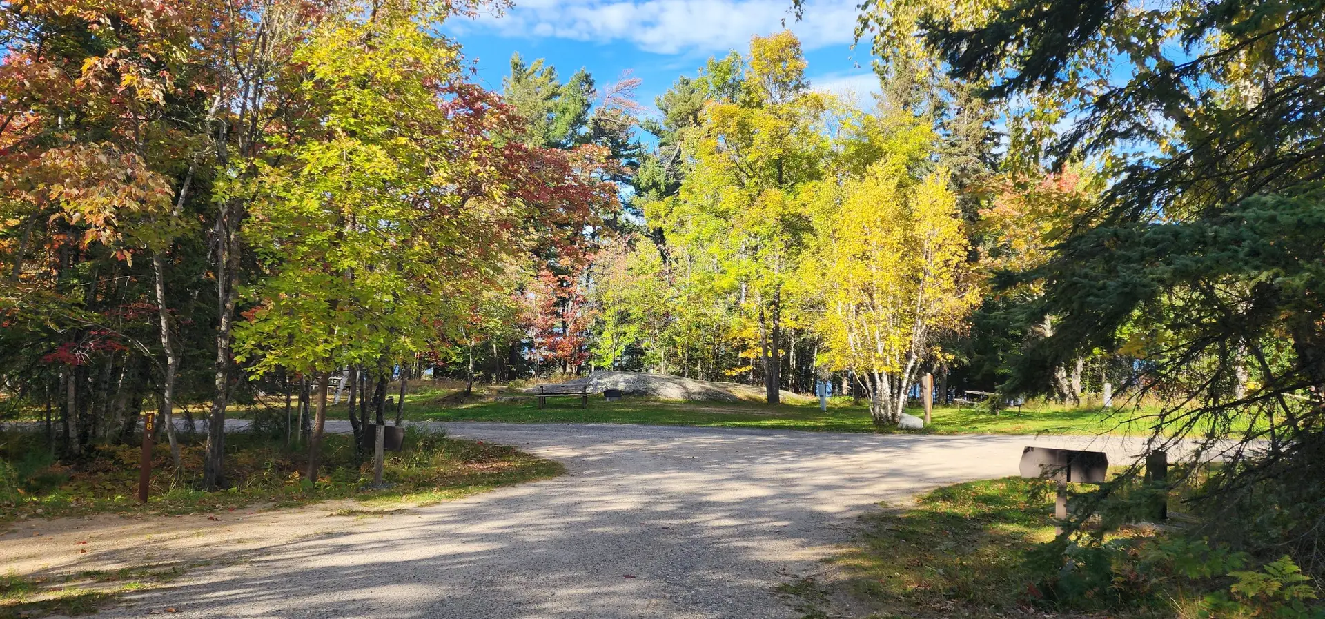


Smokey Bear State Forest is nestled in northern Minnesota’s Koochiching County, covering 12,276 acres. Located near the mouth of the Big Fork River, just south of the Canada border!
This northern forest is named after the iconic figure Smokey Bear, symbolizing wildfire prevention and forest conservation—a fitting namesake for this scenic and ecologically significant area. Smokey Bear State Forest spans across 12,276 acres. This vast, scenic area is known for its natural beauty and is a popular destination for outdoor enthusiasts.
In the warmer months, visitors enjoy hiking, biking, canoeing, and fishing in the forest’s rivers and lakes. During winter, snowmobiling, cross-country skiing, and snowshoeing offer unique ways to experience the snowy landscape.
The forest... Read more
Koochiching State Forest is located in Koochiching County, covering a vast 567,985 acres!
Koochiching State Forest spans across 567,985 acres and it’s one of Minnesota’s largest state forests. Notable features include the Myrtle Lake Peatland SNA, untouched peatlands, and access to Rainy Lake. Recreation opportunities abound, with trails for hiking, cross-country skiing, and snowmobiling.
Rules for this place
Camping away from a developed campground in a state forest is allowed under the DNR’s dispersed camping rules, which set how far from water, from a designated site and for how long. A snowmobile here needs current registration, and a sled registered outside Minnesota needs a... Read more


