


Your account
Sign in or create one
ifalls.news is free to read. An account keeps your saved items and settings.


The Black Bay Beaver Pond Trail is a 1.2-mile boat-in hiking trail in Voyageurs National Park, reached by water a mile from the Rainy Lake Visitor Center.
The Black Bay Beaver Pond Trail is a boat-in hiking trail in Voyageurs National Park, reached by boating about a mile from the Rainy Lake Visitor Center to a day-use dock on Black Bay of Rainy Lake. A brown Park Service trailhead sign marks the landing, where there is also a vault toilet; pets are not allowed on the trail.
The narrow dirt path runs 1.2 miles round trip — rated moderate, about 30 to 60 minutes — through northern pines and hardwoods and across rock ridges, with a few short, steep climbs and descents over rock and roots. It... Read more


The Battle Lake Recreation Area near Northome offers county-managed non-motorized trails for skiing, hiking, and hunter walking, plus a picnic area and sledding hill.
In the southern reaches of Koochiching County, near the small community of Northome, the Battle Lake Recreation Area gives locals and visitors a place to stretch their legs across the seasons. While the name points to the water, the area is best known for the trail complex that surrounds it.
Managed by Koochiching County Land and Forestry, the recreation area is built... Read more


Managed hiking and ski trail complex near Northome, Minnesota. Features hunter walking trails, ski trails, picnic shelters, and a sledding hill. Run by Koochiching County Land and Forestry.
Battle Lake Recreation Area is a trail complex near Northome in southern Koochiching County, managed by Koochiching County Land and Forestry. The area features skiing, hiking, and hunter walking trails. No motorized vehicles are allowed.
Amenities at the trailhead include a picnic area with tables and a sledding hill with sleds stored on site. Some trail sections are only accessible in winter on skis. The hiking trails wind through mixed birch and aspen forest with some steep hills. The trail system leads out to Battle Lake, a marshy basin that attracts waterfowl in spring and fall.


Rainy River Wayside offers walking trails and carry-in watercraft access!
Rainy River Wayside offers walking trails and carry-in watercraft access!


Little American Falls is a hidden gem that offers a perfect day trip or camping trip for nature enthusiasts and adventurers.
In the serene wilderness of South Koochiching County, Little American Falls is a hidden gem that offers a perfect day trip or camping trip for nature enthusiasts and adventurers. This charming waterfall is part of the Big Fork River, a waterway renowned for its scenic beauty and recreational opportunities.
The journey to Little American Falls is an adventure in itself. Paddlers can follow a scenic route that takes them through lush forests and along winding rivers. The hiking trail is particularly stunning in the spring, when the water... Read more


The Beaver Pond Overlook is a key attraction in Voyageurs National Park!
The Beaver Pond Overlook is a key attraction in Voyageurs National Park, located near the Rainy Lake Visitor Center. It provides a unique opportunity for visitors to observe the influence of beavers on the local environment and learn about the boreal forest ecosystem. Interpretive signs along the trail offer insight into the park’s natural history and the cultural significance of the area to the Ojibwe people.
The trail to the Beaver Pond Overlook is a 0.2-mile (0.3 km) round-trip hike. The path is relatively easy, with a few slight inclines, making it suitable for most visitors. The trailhead... Read more


The Voyageurs Forest Overlook Trail is a 0.4-mile loop located near the Ash River Visitor Center in Voyageurs National Park.
The Voyageurs Forest Overlook Trail is situated near the Ash River Visitor Center in Voyageurs National Park. It is accessible from the first parking area on Meadwood Drive, making it easy to find for visitors coming to explore the Ash River area.
The trail is a 0.4-mile loop with moderate difficulty, featuring a mix of elevations and forest types, making it suitable for a short but engaging hike. However, due to uneven terrain and slight inclines, the hike may be challenging for individuals with mobility issues. The trail showcases a variety of trees, including white... Read more


The Lost 40, located in Minnesota’s Chippewa National Forest, is a rare remnant of old-growth forest that was spared from logging due to a surveying error in 1882. Today, this 114-acre area stands as a critical habitat for diverse wildlife and a living testament to the region’s ecological history.
The Lost 40, located in the Chippewa National Forest, is a pristine example of Minnesota’s old-growth pine forest. This area remained untouched by logging operations, which decimated much of the region’s original forests, due to a surveying error in 1882. The surveyor, Josiah A. King, mistakenly plotted Coddington Lake about half a mile further northwest than its actual location. As a result, the 114-acre area known today as the Lost 40 was never logged, preserving a rare stand of virgin red and white pine trees.
A Snapshot of the Past
The Lost 40 is home to some of the... Read more


Kabetogama State Forest, located in Koochiching and Saint Louis counties, Minnesota, spans 621,499 acres!
Kabetogama State Forest, covering 621,499 acres in northeastern Minnesota, is renowned for its rugged beauty and extensive forests. Bordering Voyageurs National Park, it offers an ideal setting for year-round outdoor adventures.
The forest features dense woodlands of fir, spruce, and birch, along with rocky ridges and wetland areas. Its lakes and forests support diverse wildlife, including moose, black bears, and bald eagles.
Visitors enjoy boating, fishing, and canoeing on Kabetogama Lake’s 25,000 acres of water in the summer months. In winter, the Arrowhead State Trail provides... Read more


Oberholtzer Hiking Trail offers stunning views throughout Voyageurs National Park!
The Oberholtzer Hiking Trail is a 1.6-mile loop located near the Rainy Lake Visitor Center in Voyageurs National Park. Named in honor of Ernest Oberholtzer, a prominent conservationist, the trail offers visitors a glimpse of the diverse landscapes in the park, ranging from deciduous and coniferous forests to wetland areas with scenic views.


This 190-acre Wildlife Management Area (WMA) borders the Big Fork River and mainly consists of diverse forest types!
The Loretta (Schaedler) Waldbillig Memorial State Wildlife Management Area (WMA) was established to honor local conservationist Loretta Schaedler Waldbillig. Managed by the Minnesota Department of Natural Resources (DNR), this WMA serves as a sanctuary for native wildlife while offering recreational opportunities for the community.
The Waldbillig Memorial WMA spans over 197 acres and is known for its diverse mix of habitats, including wetlands and forested areas. This variety creates a thriving ecosystem, attracting a wide range of animals. The area is especially popular with birdwatchers... Read more


The Blue Ox Trail spans 74 miles, tracing the path of an unused railway line and offering a smooth, straightforward ride!
The Blue Ox Trail spans 74 miles, tracing the path of an unused railway line and offering a smooth, straightforward ride. The landscapes of black spruce, swamps, and aspen uplands offer a beautiful experience in every season, and the trail is a haven for wildlife watchers, with chances to spot beavers, eagles, moose, wolves, and bobcats along the way. The trail is a gift from Koochiching County and is cared for by the Northome Ridge Riders.
From International Falls, the trail follows the old rail grade south along the Highway 71 corridor, passing through Littlefork, Big Falls, and Funkley before... Read more


Enjoy stunning views around the International Falls/Ranier area on a paved bike path!
Suitable for biking, jogging, walking.
Paved surface with enough room for riding bikes side by side.
Starts by the IFalls Chamber of Commerce in International Falls and ends across from Ranier Park in Ranier.
Pets are allowed with leash.
Passes by the Voyagers National Park Headquarters building and the Pat Roche Landing.
Along the way you will find Kiosks with information about notable buildings from our past and the early days of International Falls and Ranier.
Koochiching County is responsible for maintaining the bike path.


Riverview Park offers a playground, a short hiking trail and picnic shelter!
Lofgren Park offers public water access, a campground, disc golf, and more!
Lofgren Park offers public water access, a campground, disc golf, and more!


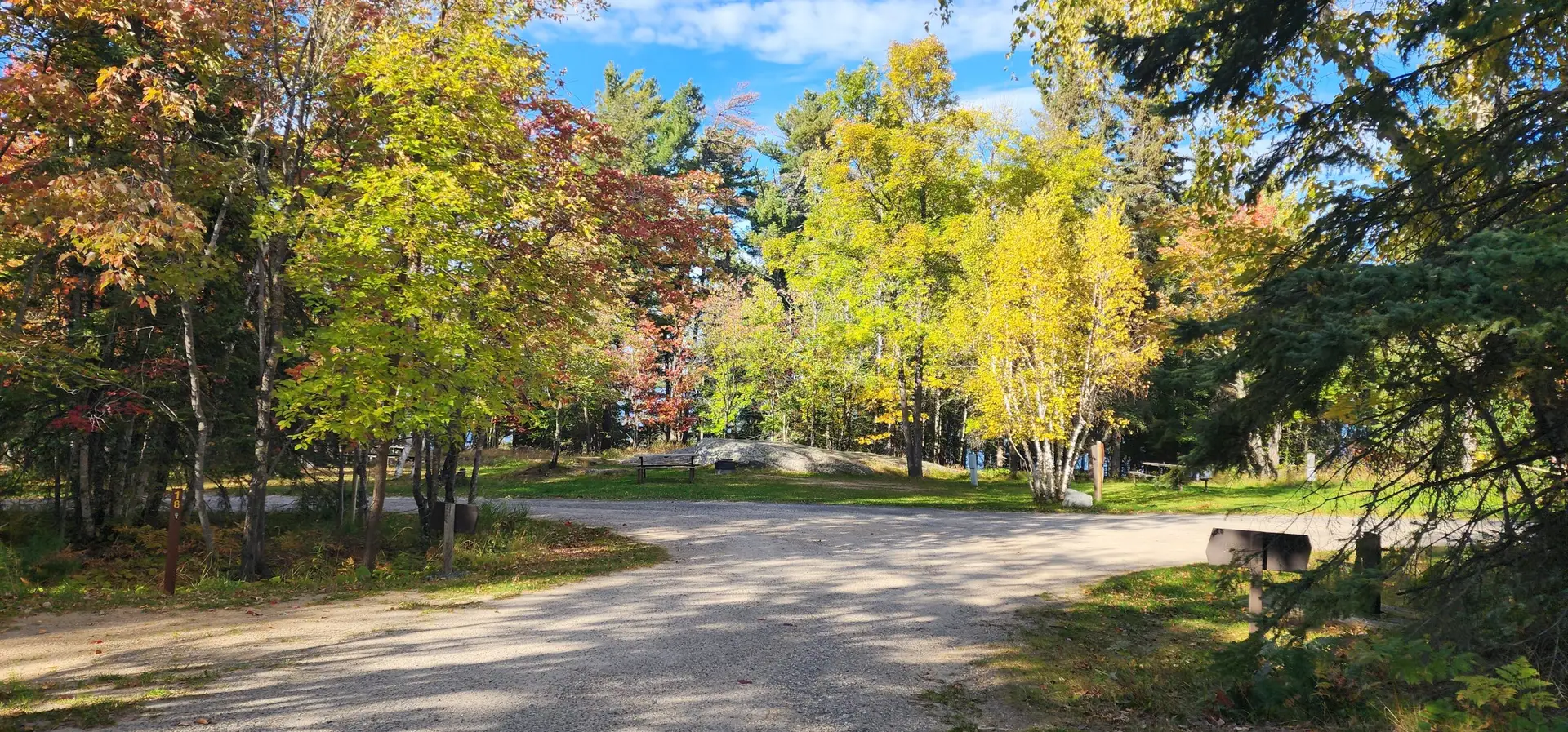
Woodenfrog Campground offers primitive campsites, public water access, public beach and hiking trails!
Woodenfrog State Forest Campground offers 61 primitive Campsites. Each site has a fire ring, picnic table, toilet access, and seasonal drinking water. Sites are first come, first served!
Campsites can be booked using the Yodel portal.
Rules for this place
State forest camping runs on the DNR’s state forest rules, which set how long a stay may run in a developed campground. Camping away from a developed campground in a state forest is allowed under the DNR’s dispersed camping rules, which set how far from water, from... Read more




Enjoy the beauty of Tilson Bay with its public water access, bogwalk, and hiking/skiing trails!
Tilson Bay is a hot spot for nature lovers and fishermen. The area includes hiking trails, cross country ski trails, snowshoe trails, a bogwalk, a fishing pier, and a public boat landing!
Tilson Bay’s bogwalk is a half-mile long walkway takes you through a fascinating bog ecosystem that supports a variety of plants and animals. You will see the distinctive tamarack trees, which shed their needles every fall, and the carnivorous plants that trap insects with their sticky leaves. You will also experience the sensation of walking on a floating sidewalk, as the walkway is made from boards that rest... Read more


Voyageurs National Park is renowned for its pristine lakes, ancient forests, and abundant wildlife!
Voyagers National Park (VNP) is a stunning natural reserve located in northern Minnesota. This park is renowned for its pristine lakes, ancient forests, and abundant wildlife, and offers visitors a unique and immersive experience in the great outdoors. Whether you’re a nature enthusiast, a recreational adventurer, or simply seeking to enjoy the scenery, VNP is a destination worth exploring.
Established in 1975, Voyagers National Park spans over 218,000 acres and encompasses four major lakes: Rainy Lake, Kabetogama Lake, Namakan Lake, and Sand Point Lake. These interconnected lakes form a vast water-based wilderness area that attracts boating, fishing, and kayaking enthusiasts... Read more


Ash River Campground offers campsites, river access, and more!
At Ash River Campground each site has a picnic table, fire ring, toilet access, and seasonal drinking water. First come, first served!


The Vermilion River stretches 42 miles northward from Lake Vermilion to Crane Lake, meandering through the Kabetogama State Forest!
Stretching approximately 40 miles from Lake Vermilion to Crane Lake, the Vermilion River flows generally northward through the Kabetogama State Forest. Along this path, paddlers are surrounded by forests of pine, spruce, fir, aspen, and birch, with scenic stretches of exposed bedrock and bluffs. The most developed areas along the river are near Vermilion and Crane Lakes and the town of Buyck.
With limited access points and a variety of rapids, the Vermilion River is best suited to experienced paddlers. Gradual water level changes... Read more


